
October 3, 2014
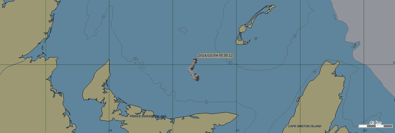
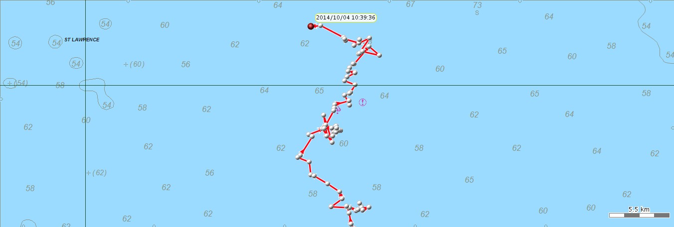
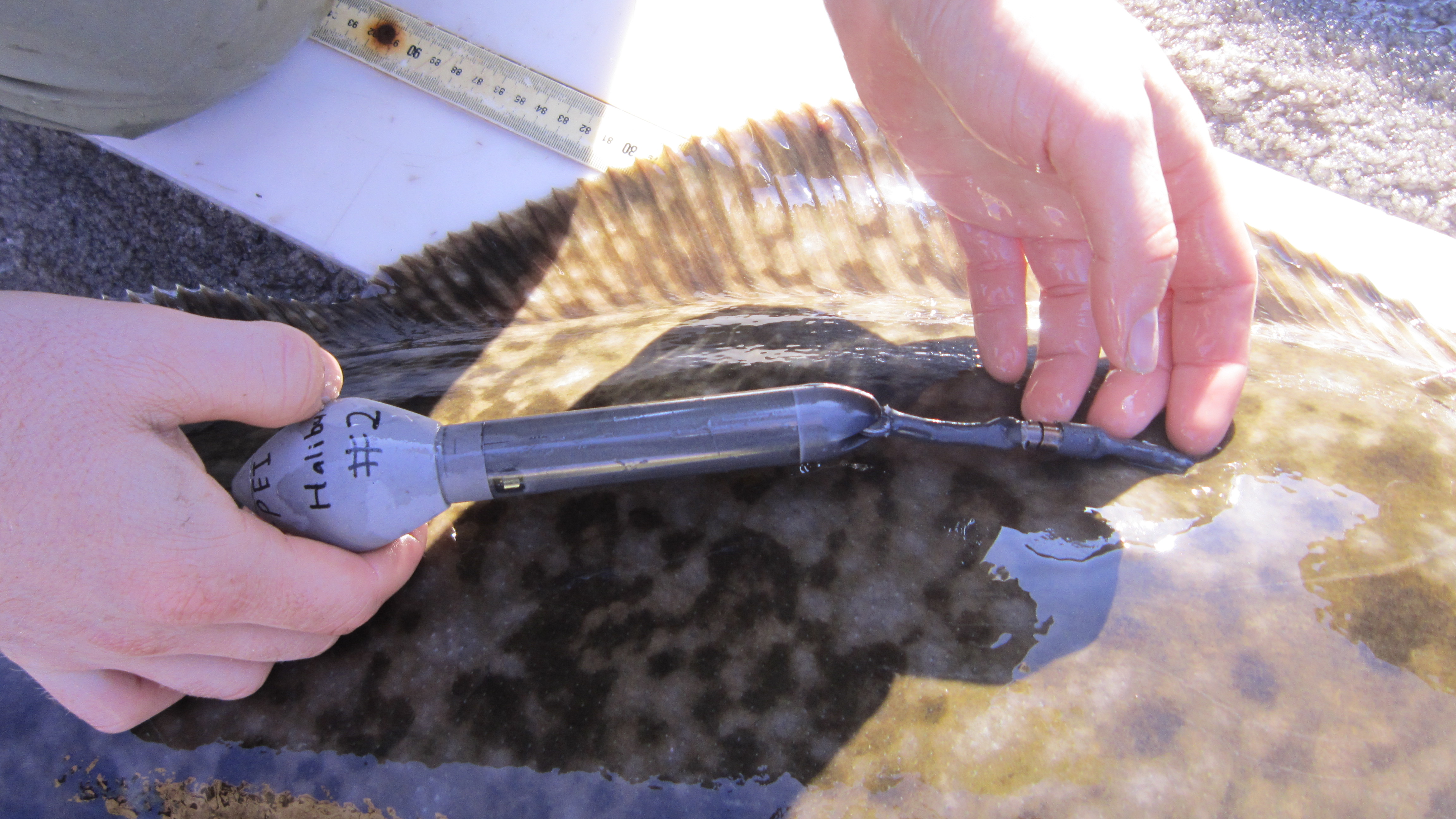
Attached are maps to the location of one (Tag A) of the two pop up satellite tags that were placed on large halibut in Nov 2013 off Morell.
Today's Coordinates:
| Time | Longitute | Lattitude |
| 9:46AM | 47.02.58 | 6242.54 |
| 7:42AM | 4702.18 | 6241.11 |
| 5:25AM | 4701.33 N | 6240.09 W |
We are seeking to obtain the tag in order to download all available data on that fish. CASH REWARD OF $500 FOR RETRIEVAL OF THIS TAG. Any assistance in retrieving this tag would be greatly appreciated
Please share with others, my cell is (902) 393-2281 and Travis James is (902) 629-4821. Travis will email us new satellite positions as they become available.
Laura Ramsay
Research & Liaison Officer
PEI Fishermen’s Association
(902) 566-4050
Telephone: (902) 566-4050
Fax: 902-368-3748
Follow us
Instagram:
@peifishassoc
Facebook:
@princeedwardislandfishassoc